File:Gb4dot.svg
Jump to navigation
Jump to search


Size of this PNG preview of this SVG file: 712 × 1,023 pixels. Other resolutions: 167 × 240 pixels | 334 × 480 pixels | 418 × 600 pixels | 534 × 768 pixels | 1,425 × 2,048 pixels | 1,104 × 1,586 pixels.
Original file (SVG file, nominally 1,104 × 1,586 pixels, file size: 1,012 KB)
| This is a file from the Wikimedia Commons. The description on its description page there is shown below.
|
Summary
| Description |
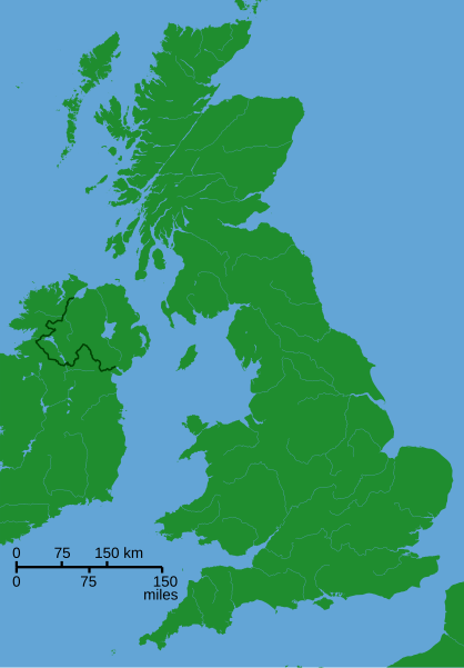
A blank locator map for Great Britain. The idea is to superimpose Image:dot4gb.svg at the appropriate point. See w:Template:GBthumb for code to do this. These two images can replace any locator map posted by Lupin - see w:Special:Contributions/LupinBot. This is a vectorized version of Image:Gb4dot.png, with the scale changed from 200 km to 150 km/150 miles. The shoreline data come from the file gshhs_h.b from the GSHHS, and the rivers and the Irish border come from the CIA World DataBank II; both sources are in the public domain. Mercator projection. |
| Date | 8 August 2006 (original upload date) |
| Source | No machine-readable source provided. Own work assumed (based on copyright claims). |
| Author | No machine-readable author provided. Wereon assumed (based on copyright claims). |
Licensing
| I, the copyright holder of this work, release this work into the public domain. This applies worldwide. In some countries this may not be legally possible; if so: I grant anyone the right to use this work for any purpose, without any conditions, unless such conditions are required by law. |
derivative works
Derivative works of this file:
- Great Revolt England 1173.png
- King John's campaign 1215-6.png
- Political map of England 1140.PNG
- Political map of England 1153.PNG
Other versions
-
 A variant with merged paths and alternative colors

File history
Click on a date/time to view the file as it appeared at that time.
| Date/Time | Thumbnail | Dimensions | User | Comment | |
|---|---|---|---|---|---|
| current | 18:40, 8 August 2006 | | 1,104 × 1,586 (1,012 KB) | wikimediacommons>Wereon | de-Inkscaped; de-emphasized rivers |
File usage
The following 2 pages use this file: