


What is the Atlas of Hillforts?
Hillforts are enormous archaeological sites dotted around Britain and Ireland. There are some of the most impressive remains from prehistory. Just five years ago the best guess for how many there might be was ‘likely … over 4000’, but now thanks to the efforts of the University of Oxford and the University of Edinburgh we know there are 4,147 and have a wealth of information about them at our fingertips.
Back in 2013, archaeologists at Oxford and Edinburgh teamed up to work on the Atlas of Hillforts. Their four-year mission was identify every single hill fort in Britain and Ireland and their key features. This had never been done before, and as Oxford’s Prof. Gary Lock said it would allow archaeologists to “shed new light on why they were created and how they were used”.
Some hillforts like Maiden Castle are well known and archaeologists have examined them for decades, but these give us only a postage-stamp-size glimpse of the huge overall picture. There are thousands of hillforts in Britain and Ireland, so if you want to understand them it’s important to have foundational information such as how many there are, where they can be found, and to build on that by adding information on what type of site it is. The more information there is, the more analysis you can do. That’s what the Atlas set out to achieve.
When the project was under development, Wikimedia UK was supporting a Wikimedian in Residence (WIR) at the British Library, Andrew Gray. He talked to the the people involved in the project and suggested using Wikipedia to share the results of the project. After all they were going to create a free-to-access online database. Perhaps the information could be used to update Wikipedia’s various lists of hillforts?
Fast forward to the summer of 2017 when the Atlas launched. At this point Wikimedia UK was supporting a WIR at the University of Oxford, Martin Poulter. His work includes helping researchers use the Wikimedia projects to increase their impact, and he worked with the Atlas of Hillforts project to share information from their database on Wikidata. Together they selected a set of information from the Atlas which Martin then uploaded to Wikidata.
Why is this project important?
It contains a huge amount of information: details of investigations at each site, a bibliography of related sources, even what kind of dating evidence there is. If you are writing about hillforts today – whether as an academic or for Wikipedia – it would be a very good idea to start by going to the Atlas of Hillforts to see what information it has on a site and what other sources of information it signposts.
For example, here is the record for Mellor hillfort in Greater Manchester. It includes any alternative names, its reference number for the Historic Environment Record (HER), a grid reference, and a summary of the site. It also gives details of nine sources you explore for more information, and tells you when it was investigated (geophysical survey in 1998 and excavated between 1998 and 2009). It tells you what kind of dating evidence there is, and you might notice there here it doesn’t have information on how many entrances the hillfort had and what shape they were. That’s because the site has been largely destroyed, as mentioned in the summary. That gives a Wikipedia editor a lot of information to work with.
Creating an atlas like this is a crucial way to share information; it creates a gold standard for information in the field and because it is much easier to find information about a site, it’s easier to stay up to date, make comparisons with other sites, and spend more time analysing this information and pushing forward our understanding.

Why is this useful for Wikipedia?
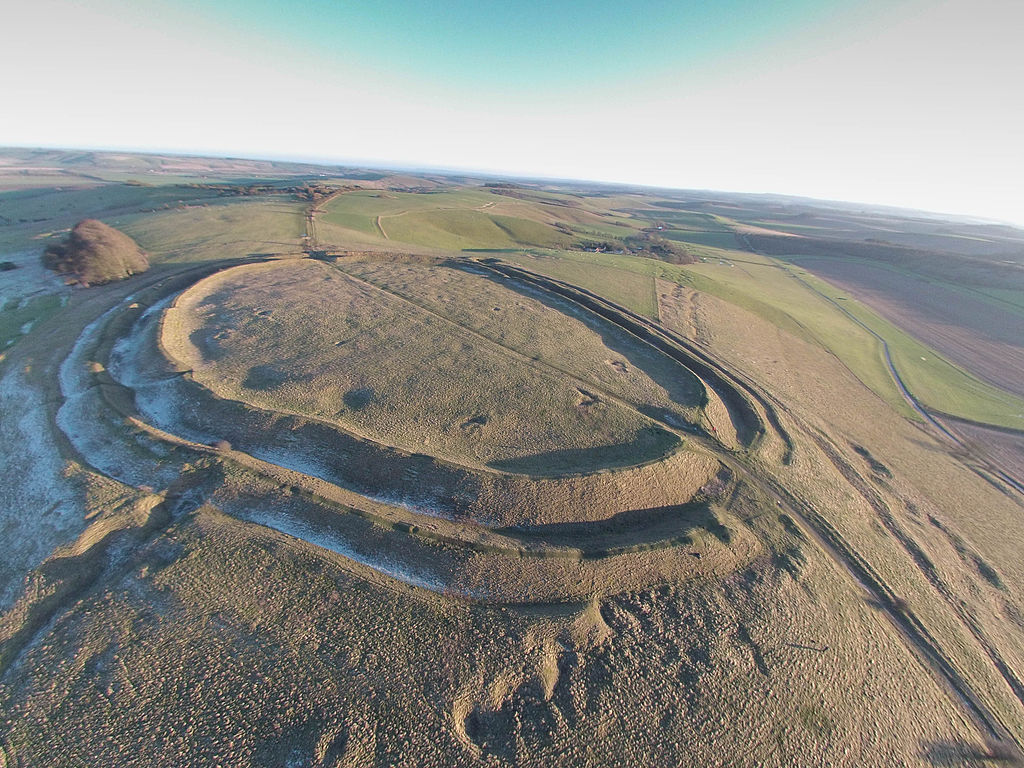
The information from the Atlas can be used to update lists as initially hoped as well as create visualisations for Wikipedia, and be used by editors to update and create articles. The English Wikipedia’s pre-existing content on hillforts was seen by 5,299 people a day in June 2017. Since the information is in Wikidata, it can be used in different language Wikipedias. The appeal of Wikimedia isn’t just the reach of the project, but the fact that in Wikimedia Commons it has a database of free-to-use images. There are nearly 3,600 media files of hillforts on Commons which complements the Atlas which only has vertical aerial photos from Google Maps.
Most importantly, the Atlas is a very high quality resource which will benefits Wikipedia’s editors and readers. It is likely to be used again and again and shape how people understand these prehistoric sites.
For more technical information on how the data from the Atlas was added to Wikidata, see Martin Poulter’s blog post on the Bodleian’s website from October.