


.png)
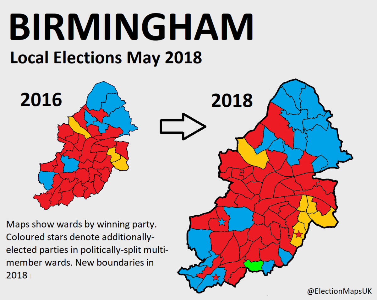
One account I follow on Twitter which produces very useful political maps is @ElectionMapsUK. I saw the account tweeting recently that after they had finished all their maps showing the changes to council seats and the makeup of borough councils after the 2018 local elections. The account announced that they were happy for other people to use the maps for any purpose they wanted, and so I asked whether they would consider publishing the maps on Open Licenses so that we could use them on Wikipedia.
They agreed and uploaded 117 maps to Flickr which I then transferred to Commons with Magnus Manske’s Flickr2Commons tool. You can find them all here.
I spoke to Election Maps UK’s creator, Ed Williams, who said:
“I’ve always been a general map nerd – and an election nerd – so the election maps were the best part of election nights in my mind! I’ve also for a good while loved the little almost cult-like gathering around local by-elections on a Thursday night (mainly thanks to Britain Elects really getting this out there) and thought as an experiment to map a couple of these (Herefordshire and West Somerset were up that week). From the start it seemed that people liked it and by the time I handed over the account after 15 months at the helm we’d passed the 13k follower mark including major politicians (Cabinet minsters, Jezza, etc) plus major journalists and a couple of best-selling authors. Obviously with the local by-election maps, followed the General Election maps – including various ones of interest covering turnout, women MPs, Blair vs Corbyn seats, etc. But it was the local election maps that really took off the most as these were things that no-one else was really covering in real-time. Wikipedia had some, Andrew Teale slowly gets them out – but as he covers all the results in full detail too his task is mammoth and always months behind, etc.
Why did I want to give them to Wikimedia? Well, this was always a hobby and therefore nothing financial. Also the resources I used – Ordnance Survey for the maps, the council websites, Andrew Teale’s excellent Local Election Archive Project and indeed Wikipedia, are all either public domain or creative commons. As such when you asked me to donate it seemed a reasonable thing to do. I also hadn’t set up a website and as I enjoy sharing these maps but only had them on twitter it seemed like a great place for them to go.”

You can follow Ed on Twitter at @HImpartiality, as he has now moved on from map making and @ElectionMapsUK is under new management.
As well as the election maps, we have also had donated a large selection of photos from the recent ‘People’s Vote march’ demonstration, which you can find here or under the [[Category:People’s Vote March]].
If you use any of the images that have been released to improve a Wikipedia page, why not get in contact and let us know? We’d love to know what you’re doing with these images. If you want to publish any of your photos on Wikimedia Commons under Open Licenses and need advice on how to do it, we’re here to help!