File:Rubbles of the cathedral after the earthquake that hit the Capital Port au Prince just before 5 pm on 12 January 2010.jpg
Jump to navigation
Jump to search
Size of this preview: 1,280 × 853 pixels. Other resolutions: 320 × 213 pixels | 640 × 427 pixels | 800 × 533 pixels | 1,024 × 683 pixels | 3,000 × 2,000 pixels.
Original file (3,000 × 2,000 pixels, file size: 2.35 MB, MIME type: image/jpeg)
| This is a file from the Wikimedia Commons. The description on its description page there is shown below.
|
Summary
| Description |
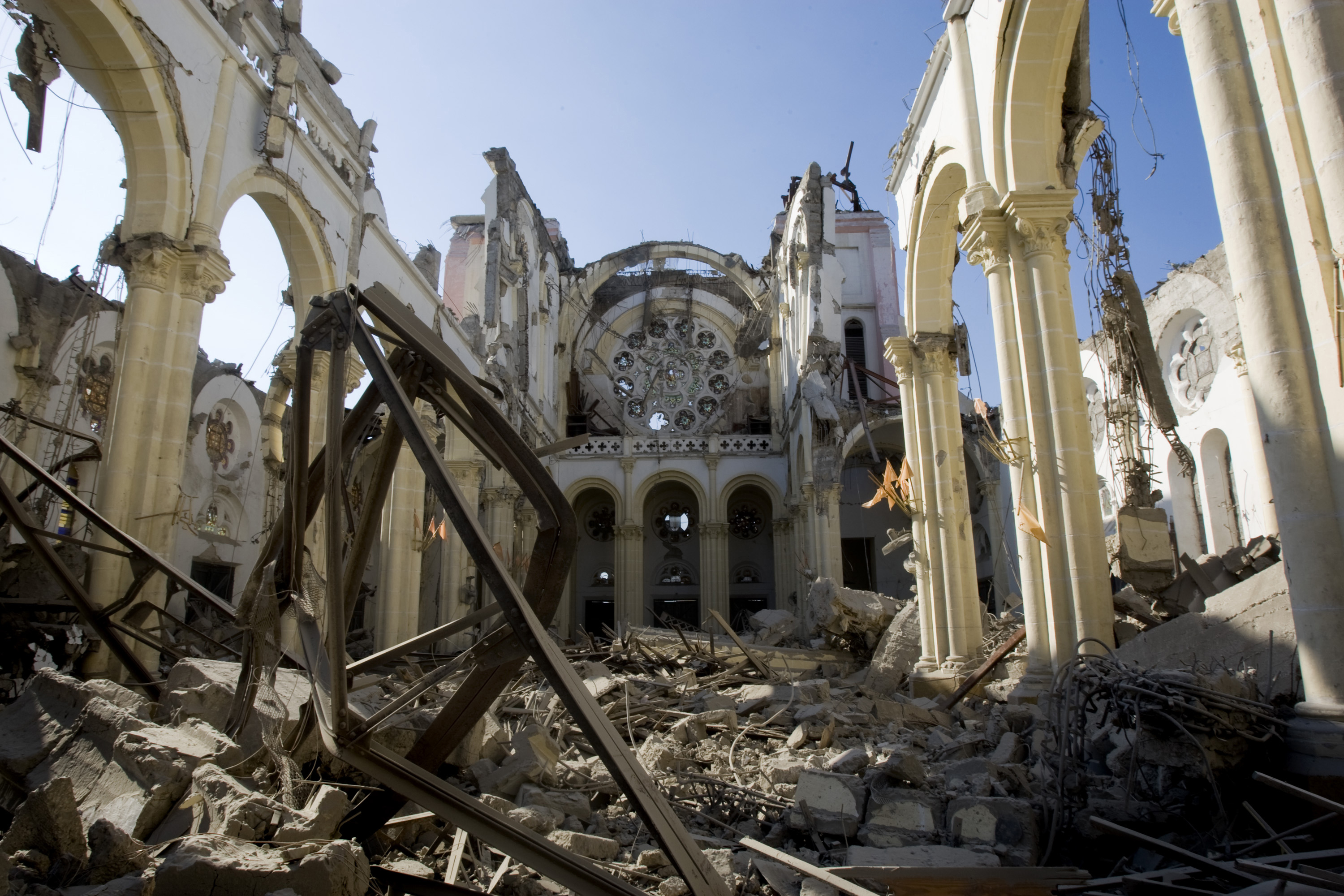
English: Rubbles of the cathedral after the earthquake that hit the Capital Port au Prince just before 5 pm on 12 January 2010
Română: Ruinele catedralei după cutremurul care a zguduit capitala Port au Prince în jurul orei 17 la 12 ianuarie 2010 |
||
| Date | |||
| Source |
|
||
| Author | Marco Dormino | ||
| Permission (Reusing this file) |
|
| Object location | | View this and other nearby images on: OpenStreetMap |
|---|
Licensing
This file is licensed under the Creative Commons Attribution-ShareAlike 3.0 IGO license.
- You are free:
- to share – to copy, distribute and transmit the work
- to remix – to adapt the work
- Under the following conditions:
- attribution – You must give appropriate credit, provide a link to the license, and indicate if changes were made. You may do so in any reasonable manner, but not in any way that suggests the licensor endorses you or your use.
- share alike – If you remix, transform, or build upon the material, you must distribute your contributions under the same or compatible license as the original.
File history
Click on a date/time to view the file as it appeared at that time.
| Date/Time | Thumbnail | Dimensions | User | Comment | |
|---|---|---|---|---|---|
| current | 21:38, 22 December 2014 | | 3,000 × 2,000 (2.35 MB) | wikimediacommons>John Cummings | higher res |
File usage
The following page uses this file: